Interactive France
since 2026 · ongoing
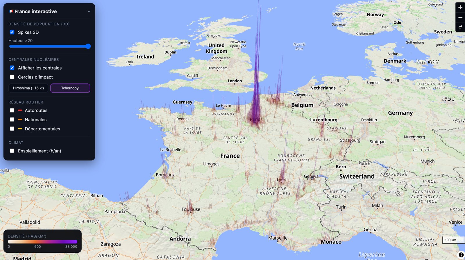
A 3D map of France where the population stands up as spikes — Paris a purple needle over the Île-de-France — with layers to switch on: nuclear plants and their impact circles, roads, sunshine.
France, tilted, and the people drawn as spikes: every commune rises in proportion to its density, from a pale stubble in the countryside to the purple needle of Paris, with Lyon, Lille, Marseille, Toulouse and the Riviera standing out around it. A slider sets the height, ×1 to ×20, so the country can be read flat or made to bristle.
Then the layers you switch on and off, one at a time or together: the nuclear plants, and around each an impact circle at the scale of Hiroshima (~15 kt) or of Chernobyl, to see who lives inside; the road network in three colours, motorways, national and departmental roads; the climate, in hours of sunshine per year. A legend gives the density scale, 0 to 38,000 inhabitants per km².
Nothing to prove, only a way of looking: what the country looks like when its numbers are given a height.
Images